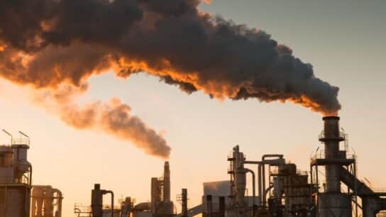
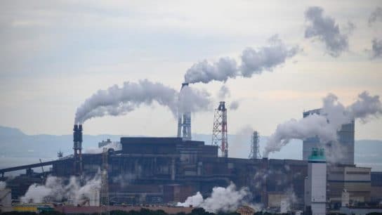
Air pollution is the third leading cause of death worldwide, and most large cities, have fine particulate matter (PM2.5) levels above WHO health guidelines. Here, we take a look air pollution mapping in Manchester to better understand the current situation, and where things may be heading.
—
Manchester is known as being one of the most polluted cities in the United Kingdom. But how did this come to be? In order to understand, let’s go back to the late 18th century when Manchester was a collection of interconnected towns undergoing industrialization.
The agglomeration’s population grew sevenfold in the 18th century, and continued to grow rapidly during the following one as the textile industry boomed and steam power came about. Manchester became the cotton textile hub of the nation, which itself was the cotton textile hub of the world during the 19th century.
It wasn’t long before the people began reporting the nuisances of heavy industry. In 1800, the Commissioners of Police in Manchester created a committee to oversee the problem; it found that “the increase of steam engines as well as smoak issuing from chimnies used over stoves, foundries, dressers, dyehouses and bakehouses are become a great nuisance to the town”.
This was only the beginning of course, as the following century saw the appearance of engineering, chemicals and metal working, sulphuric acid and naphthalene production and many more noxious affairs. Reports from local or foreign writers passing through are vivid, like Alexis de Tocqueville’s commentary: “These vast structures keep air and light out of the human habitations which they dominate; they envelop them in perpetual fog; […] A sort of black smoke covers the city. The sun seen through it is a disc without rays.”
The first scientific measurements and analyses of the situation were carried out by R.A. Smith who, in his 1852 paper, described and coined the term “acid rain”. He found that sulphur pollution around Manchester mixed with precipitating water and dropped its pH from the usual ~5.5 to 3.5. He also described its negative effects on the surrounding vegetation, and noted the disappearance of some species from the region, such as the sphagnum mosses.
The next 50 years saw a succession of local initiatives, like that of the Salford Noxious Vapours Abatement Society that obtained black smoke emission regulations, to the Smoke Abatement Society of Manchester, founded in 1909 and precursor to the Smoke Abatement League of Great Britain.
Around the same time, the first deposit gauges were set up around the city. These rudimentary sulphur deposit measurements often read 170 kilograms per hectare (100 x 100 meter square) per year.
Better measurement techniques came about during the second World War, and their readings came up with mean sulphur dioxide concentrations of 586 micrograms per meter cube (mg/m3), compared to the 20 mg/m3 WHO guideline value today. Of course, with the sulphur were other pollutants like particulate matter, only these were harder to identify, isolate and measure.
The result was a high incidence of respiratory disease throughout the 20th century. In December 1930, a December like any other, there were 137 respiratory disease deaths in Manchester. The following year, a severe smog engulfed the city for 9 days and 592 people died of respiratory disease. Catastrophe is often the impetus for change, and following this one, negotiations for the creation of a smokeless zone were launched. Mancunians had to wait for the City to acquire private powers to implement the zone in 1946. Six years later, the great London Smog caused an uproar, leading to the Clean Air Act of 1956.

Source: Douglas, Ian, Rob Hodgson, and Nigel Lawson. “Industry, environment and health through 200 years in Manchester.” Ecological Economics 41.2 (2002): 235-255.
As you can see, the Clean Air Act was highly effective in reducing sulphur dioxide (SO2), smoke deposits, and thus bronchitis in the City of Manchester. It is important to note, however, that this was greatly helped by the decline of heavy manufacturing and the substitution of coal with electricity, gas and oil.
You’ll also notice the subsequent peak in lead (Pb) levels in the mid 1980s. Lead was actually added to fuels in the 1930s, and became progressively more widespread until its extremely negative health effects became apparent. It’s late appearance in the graph is due to a lack of record prior to the first data point, similarly to NO2 (nitrogen dioxide). It can be hard to rein in NO2 because of the amount of vehicles so the road in large agglomerations; still, fuel switching and a range of pre-treatments have helped control it.
Today, standards are better informed by science, and we able to take things one step further: precise air pollution mapping is possible, both in Manchester and cities around the world. Making this information publicly accessible would allow all to understand what they are exposing themselves to, and possibly make better decisions for their family’s health and their own.
Berkeley Earth made a PM2.5 to cigarette equivalence that has allowed us to map air pollution in Manchester in terms of cigarettes smoked per week.

Air pollution mapping in Manchester. PM2.5 data from NASA-SEDAC (2016).
This snapshot of Manchester’s PM2.5 puts things into perspective – what is considered to be a fairly low amount of pollution on the global stage is still equivalent to about 3 to 4 cigarettes per week. The point is, no level of air pollution is good, and the WHO’s guideline of 10 mg/m3 of PM2.5 is just a relatively acceptable level. It is likely we will one day get rid of pollutants (close to) entirely and look back on these times as dangerously and unnecessarily unhealthy.
Manchester’s Director of Public Health for Air Quality, Eleanor Roaf, says, “We estimate in Greater Manchester that air pollution is the biggest environmental cause of poor health. Up to 1,200 deaths each year are contributed to by poor air quality.”

Source: Berkeley Earth.
On average, PM2.5 is close to the WHO guideline level (green), but the many spikes are the days when hospitalizations for asthma and the like become more likely, especially for children.
One of the ways the City intends to fight this is by enabling pedestrian and bicycle circulation. They’ve already created one of the largest pedestrian-cycling networks in Britain, covering 1,800 miles.
Additionally, Manchester was one of the first cities in the UK to declare a climate crisis in July 2019, signaling its intention to assume a leadership role in reducing carbon emissions and ecological footprint.
This article was written by Owen Mulhern.
You might also like: Dry Vegetation in California as it Braces for 2021 Wildfires


![The Statistics of Biodiversity Loss [2020 WWF Report]](https://earth.org/wp-content/uploads/2020/12/lprwinkyTHB-544x306.jpg)


