The Amazon rainforest is still experiencing wildfires, according to satellite imagery. Brazil’s National Institute for Space Research (INPE) reports that as many as 82,285 fires have been detected in the rainforest so far this year – a significant increase from the same period in 2018. The findings pitted scientists against national authorities who vehemently disputed the data, marring the government into an international controversy from which it was forced to back down during the latest G7 meeting in Biarritz.
—
The blazes erupted last month were so large that plumes of smoke are visible from space, and have wafted thousands of miles east to the Atlantic Coast plunging Brazil’s largest city São Paulo into hazy darkness in the middle of the day.
The Amazon has been increasingly threatened by man-made wildfires for more than three decades now. Earth.Org analysed satellite data to create a year-by-year pattern of fires across the Amazon rainforest since 2011. We used current and historical data from two NASA satellites, Terra and Aqua, which tracked the fire by detecting the infrared radiation emitted by blazes.
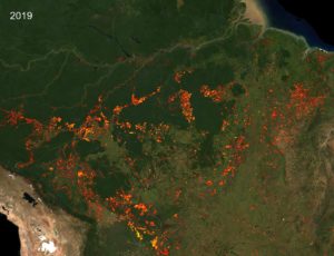
2019 — Over 18,700 sq km of the rainforest — an area larger than Fiji — are currently burning in the Brazilian part of the Amazon, while another 7,250 sq km in neighboring Bolivia too are on fire. These blazes endanger the lives of 1 million indigenous people and millions of other species and plants.
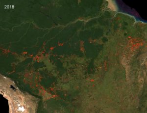
2018 — Data shows that over 45,656 fires were active this year — significantly fewer number compared to 2019.
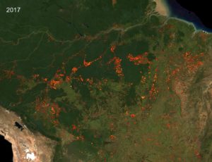
2017 — This was another worst year that recorded the highest number of fires compared to the previous 10 years. Data reveals that there was a 29% rise in the number of fires in the rainforest since 2016.

2016 — Brazil suffered its worst drought in decades and saw an outbreak of more than 68,000 fires this year.
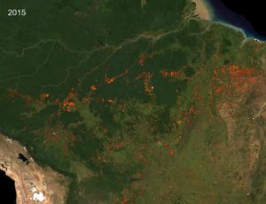
2015 — Wildfires that lasted more than two months consumed more than 4040 sq km of indigenous territory in the Maranhão region in Brazil this year. As many as 58,936 fires were recorded in Brazilian Amazon.

2014 — This year marked the beginning of a rapid rise of wildfires in the Amazon forest in this decade with 64,632 blazes was recorded in the dry season.

2011-2013 — This three year period had a fewer number of fires — over 40,000 –compared to the later years.
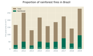
Wildfires in Brazil consume not just rainforest, but grasslands, savanna, and farmlands too. The yearly analysis shows a sharp increase in blazes that consumes rainforests compared to others.
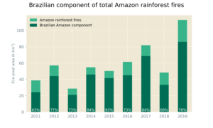
Amazon rainforest is spread across Brazil, Peru, Colombia, Bolivia, Venezuela, Suriname, Guyana, and French Guiana. Besides Brazil, other countries too witness wildfires in their territory. But fires usually consume the largest area in Brazilian Amazon compared to other countries.
What caused the Amazon fire?
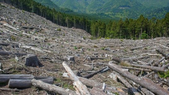
The Amazon — the largest and most diverse tropical rainforest on Earth, covering an area of 5.5 million sq km — almost never burns on its own given the moisty climate and terrain. Deforestation is directly linked to fires in the Amazon as farmers set the forest ablaze to make room for livestock pastures and crop fields while these purposeful burns get out of control. The uptick in fires in the period between August to October coincides with the seasonal planting of soybean and corn crops.
The World Wildlife Fund (WWF) estimates that 17% of the Amazon rainforest has been lost in the past five decades. Wildfires in recent years have added to that growing cumulative total of deforestation. With an increasing number of fires, Amazon eventually might reach a tipping point after which the forest might turn into a Savanna ecosystem or a seasonal forest. Every bit of satellite data we processed points to such scenarios.
The most critical task at hand to preserve the Amazon is to retain what’s left by stopping the ongoing wildfires and deforestation as quickly as possible aided by satellite imagery. Brazil and other Amazon countries will have to develop a mechanism to protect and restore the rainforest in face of rising demand for agricultural lands.


