Many countries around the world are either facing or will likely face the full-scale impacts of climate change. South America, home to the second-largest river and the world’s longest mountain range, exemplifies biological diversity and natural landscapes that breed terrestrial, marine, and aquatic life and creates a diverse environment for living organisms. Yet, the problems that the continent face are multi-fold – from hydrometeorological issues, widespread desertification, and rampant deforestation, to biodiversity loss, many countries are learning to adapt to the changing environment. Here are the top 5 environmental issues in South America.
—
5 Environmental Issues in South America
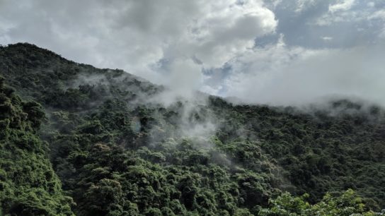
1. Deforestation
Known as one of the biggest environmental issues of our lifetime, the problem of deforestation continues to plague Brazil’s Amazon rainforests. But this region is not the only one facing the consequences of anthropogenic climate change. The Gran Chaco, the continent’s second-largest forest, has been under compounding pressure from deforestation. The semi-arid indigenous forest, which spans more than a million kilometres across Argentina, Paraguay, and Bolivia, has lost more than one-fifth of its forests (around 140,000 square kilometres or 54,000 square miles) since 1985. Besides the environmental consequences, deforestation in the Gran Chaco region is threatening the livelihood of Indigenous hunter-gatherers. According to the Natural Resources Defence Council, 27 to 43% of the land in Peru, Bolivia, Chile, and Ecuador is being affected by the rampant forest loss.

Deforestation is known to amplify climate change by releasing more carbon dioxide into the atmosphere, adding pressure on animal and plant species. In the Gran Chaco region in particular, there has been a great reduction in the number of species, including the South American Jaguar and the Screaming Hairy Armadillo.
While several measures are being adopted to curb and solve the issue, there have been numerous groups seeking to map and understand the spatial damage caused by deforestation.
Project Lanloss, coordinated by the Ca’ Foscari University in Venice, Italy, aims to map the extent of deforestation using satellite imagery and study its impacts on local communities. Dr. Tamar Blickstein, who leads the project, aims to integrate satellite images and people’s opinions in the form of a storytelling narrative, with the hope to raise awareness about deforestation in the Gran Chaco region and further educate local communities. INCLUDE, another project which ended in 2021, funded by the University of Bern in Switzerland, studied the dynamic interactions between technological, environmental, and economic factors and their influence on land use and household decisions in the province of Salta in the Gran Chaco.
You might also like: 10 Amazon Rainforest Deforestation Facts to Know About
2. Soil Erosion
Land erosion, partly a direct consequence of deforestation, currently affects more than 60% of South America’s soil and has also begun threatening the food security in the continent. More than 100 million hectares of land have been adversely affected and around 18% of Brazil’s northeastern territory has been degraded. With it, important staple food crops like maize and beans were also compromised.
The Adapta Sertão initiative, a coalition of organisations and small farmers was created to employ environmental regeneration strategies in the semi-arid Sertão region, one of Brazil’s driest areas. Some of the methods used in this programme include agroforestry systems, cover crops, and improved irrigation and production systems to increase the output of animal feed.
Aside from Brazil, more than half of the land in Argentina, Mexico, and Paraguay is deemed unfit for cultivation. According to José Miguel Torrico, the UN Convention to Combat Desertification (UNCCD) coordinator for Latin America and the Caribbean, the annual cost of land degradation in Latin America and the Caribbean is estimated at $60 billion.
Soil erosion has also been a major threat to Argentina’s landscape and biodiversity. The degradation of Argentina’s landscape has been visible due to intensive agriculture, livestock farming, and drastic changes in land use patterns in the country. According to a 2020 report published by the Ministry of Environment, 100 million hectares out of a total area of 270 million hectares are affected by erosion, and the rates of erosion have increased by approximately 2 million hectares per year. This has been attributed to the expansion of soybean agriculture and overgrazing in many regions.
In recent years, local bodies and organizations have ramped up efforts to restore and preserve landscapes in the region. One such organisation, the Network of Municipalities for Agroecology (RENAMA), brought together many Argentinian localities and producers to adopt innovative agroecological practices on more than 100,000 hectares of land. This practice includes crop diversification, economical use of biological over chemical inputs, and conservation tillage.
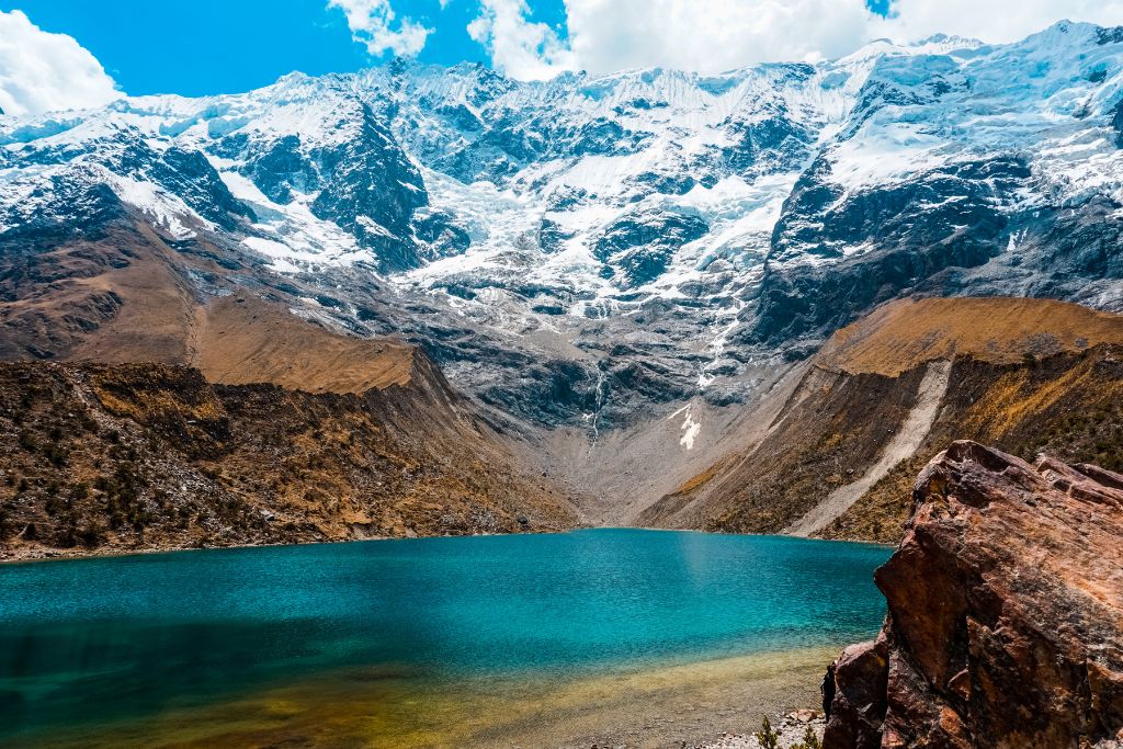
3. Glacial Melting
In several South American countries, glaciers are a crucial source of freshwater used for water consumption, agricultural activities, power generation, and ecosystem conservation. Since the 1980s, the tropical Andes (Chilean and Argentinian Andes) have been retreating, and ice mass has been dropping at alarming rates, with a negative mass balance trend of -0.97 metres of water equivalent annually in the last three decades. This continued melting, along with rising temperatures, poses a serious threat to water security among the Andean population and ecosystems.
Peru has also lost more than 40% of its glaciers. Lake Palcacocha in the central Peruvian Andes has grown 34 times larges in only four decades, being fed by the melting waters of the Palcaraju ice sheet.
The region surrounding Lake Palcacocha witnessed a catastrophic flooding event in the 1940s which claimed the lives of 1,800 people in the neighbouring city of Huaraz. According to a study carried out by scientists from Oxford University and the University of Washington, the risks of a similar event occurring again are very high, given the change in geometry of the Palcaraju ice sheet and the increase in greenhouse gas emissions in the recent past.
The Glaciers and Ecosystems Research National Institute (also known as INAIGEM) and Huaraz Emergency Operations Centre (COER) in Peru have been regularly monitoring the region around Palacocha and have also designed early warning systems to alert the population in case of a potential flooding event. These systems are also designed to educate people about the magnitude of the risk and create signposts around the city to safely guide and evacuate people in the event of a flood.
4. Water Pollution and Water Scarcity
Despite being one of the world’s largest sources of freshwater, parts of South America are dealing with an unprecedented water crisis due to poor or untreated water, wide-scale mismanagement, and overexploitation.
The nucleus of water pollution in South America is that a large portion of water goes untreated for human consumption and use. To exemplify, polluted waters which enter lakes and rivers along with human and animal waste are transferred to the water systems of many homes. Furthermore, some of the major water bodies in the continent, including the Medellin River in Colombia, Guanabara Bay in Brazil, and Argentina’s Riachuelo River, are continually subjected to large-scale industrial and anthropogenic pollution which contaminates water sources and makes water unsafe for use and consumption.
Another hydrological conundrum faced in some countries is water scarcity. Considered to be a crisis in companion with droughts, water scarcity has troubled parts of Brazil, Chile, Argentina, and Colombia.
The intense mega-drought in Chile, which began in 2007 and is still ongoing, has led to the loss of livelihoods and biodiversity and has contributed to water and food insecurity across the country.
The government has introduced certain measures to curb the problems. In the Providencia district of Chile, the government has made plans to replace existing plants along roads with more drought-tolerant plants. To reduce water wastage and combat droughts that have plagued several parts of the city, the Chilean government has also introduced water rationings and has invested in projects to modernise existing water systems.
The rationing plan consists of a four-tier alert system with public announcements and involves rotating water cuts to different parts of the city. In 2021, Emilia Undurraga, Chile’s former Minister of Agriculture, had also developed plans to restore 1 million hectares of land by 2030. This project, which foresees collaborations with Chile’s private sectors, including agriculture, mining, and energy, not only supports the restoration of native forests but also helps convert some of them into mixed-use types.
You might also like: Chile Water Crisis: 13 Years and Counting
5. Sea Level Rise
One of the World Meteorological Organization’s (WMO) most important “tell-tale” signs of extreme weather events is rising sea levels. Over the last three decades, regional sea levels have increased at a much faster rate than the global mean levels, particularly in the South Atlantic (3.52 ± 0.0 mm per year) and sub-tropical North Atlantic regions of the continent (3.48 ± 0.1 mm per year).
At present, this issue continues to threaten the coastal populations by contamination of freshwater aquifers and increasing risks of storm surges. According to the Sixth Assessment report by the IPCC, regional sea levels are likely to keep rising and will contribute to coastal flooding and shoreline retreat along the Atlantic coasts of South America. A few cities which are considered to be highly vulnerable to climate change impacts of floodings (and cyclones) are Fortaleza, Rio de Janeiro, São Paulo, and Porto Alegre in Brazil, Buenos Aires in Argentina, Santiago in Chile and Lima in Peru.
You might also like: 15 Biggest Environmental Problems of 20243