A new study reflects on the current uneven distribution of biodiversity data, its link to social inequity, and its impact on modern environmental policies. When looking at a world map of all biodiversity records, the geographical disparity is striking. Some regions of the word contain a far greater number of records than others. While the US is fully covered by data points, Brazil and China visibly have a much lower coverage, despite hosting some of the world’s key biodiversity areas. This disparity highlights the geographical bias of environmental research which, contrary to what the name might suggest, is not limited to geographical locations. For instance, some species groups are more recorded than others. To understand what this research gap means, we must first look at the current science on the distribution of environmental monitoring.
—
Research Gap: Why Does it Matter?
Research gap in environmental science is a real issue, and even more so today. Nowadays, nature can be transformed into economic assets, carbon stored by plants can be quantified and sold as carbon credits, similarly, biodiversity can now be monitored and transformed into biodiversity credits. This way, the rise in carbon and biodiversity markets facilitate money flows towards regions that lack economic support for the protection of. Yet, in order to determine the natural assets of a region, one needs data. And this is where inequalities are impactful: regions with higher records of biodiversity will find it easier to justify and access finance for environmental protection.
The same applies to policy.
Policies and regulations for environmental protection are often targeted towards areas of high ecological priority. The priority of an area is once again determined by the data available, including biodiversity rates, the presence of endangered species, forest density, deforestation risks, etc.
Consequently, the uneven distribution of environmental data could have important impacts on environmental governance and policy, prioritising some areas and marginalising others. But where do these biases come from and what are the factors driving environmental monitoring?
You might also like: Nature Credits Can Succeed Where Carbon Capture Technologies Failed: An Interview with Walid Al Saqqaf and Amit Ghosh
Existing Inequalities in Environmental Research
Geographical location is where we observe the most disparities in environmental data distribution. This is due to multiple factors: accessibility to different locations, research interest and priorities, technologies available, and, unsurprisingly, the wealth of a country.
Indeed, biodiversity monitoring is often proportional to a country’s GDP. A 2024 study on the current uneven distribution of biodiversity data found that high-income countries have seven times more observations per hectare than upper middle, lower middle, and low-income countries.
When looking at the Global Biodiversity Information Facility (GBIF), a data repository compiling billions of species observations worldwide, disparities in environmental research become apparent. Indeed, 79% of the available data comes from just ten countries, with a staggering 37% from the US.
But the uneven distribution of environmental data goes beyond countries and their financial resources.
Accessibility, for instance, is another important driver of environmental monitoring, since researchers will mostly likely monitor data in places that are easy to access. More than 80% of biodiversity data worldwide are recorded within 2.5 kilometres (1.6 miles) from roads. While favouring accessible places over remote areas is somewhat understandable, this inevitably also discriminates against low-income nations, which lack the financial resources to build adequate road infrastructure and transportation.
Data recorded through citizen science can also be a driver of data disparities. Citizen science refers to the participation of the public in recording scientific observations. Whilst this method of observation can be highly valuable for scientific research, it can be highly biased. Indeed, citizen observations are more likely to represent certain groups of species. This is because individuals are more likely to record animals which are easily spotted, or which spark their interest, such as birds or rabbits, for instance.
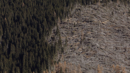
Another strong bias in environmental data lies within the research topics of environmental studies. For instance, while some species are largely monitored, others are considered less relevant. Birds, a favourite of wildlife enthusiasts, are by far the most overrepresented species, accounting for 87% of all GBIF data. This applies to biomes, too. Generally speaking, urbanised regions and terrestrial ecosystems are the most represented by studies, whilst tropical regions are poorly represented, despite being the most biodiverse biomes in the world.
These disparities are explained by many factors, often reflecting socio-demographic realities. Disparities in environmental research can be linked to historical legacies of armed conflicts, political regimes, corruption, democracy, economic development.
You might also like: The Remarkable Benefits of Biodiversity
The Impact of Data Disparities
Inequalities in data availability can have strong social, political, and environmental consequences.
For instance, environmental threats such as invasive species might be observed at an earlier stage in areas of high monitoring coverage. Actions and investments towards environmental management are thus more likely to occur in these research hotspots.
The aforementioned study suggests this could favour, for instance, government-managed parks – which are more monitored and whose database is more important – over indigenous lands – which might not be tracked and monitored by scientific publications despite hosting a significant (often higher) number of animal and plant species. And so, indigenous communities risk being marginalised.
The Future of Environmental Data
In recent years, more technologies are becoming available to access environmental data, such as remote sensing, satellite imagery, or artificial intelligence. Ecological modelling can be a powerful tool, too. Biodiversity can be modelled using other environmental factors, such as climatic and altitudinal ranges, giving us an accurate idea of the global distribution of flora and fauna.
Despite existing solutions, to this day, the coverage of environmental data remains uneven, and research efforts are still lacking in places that require urgent conservation efforts. Research gaps should thus be carefully considered to avoid the marginalisation of certain regions and communities in environmental finance and policy.